
How to Export Meshtastic Tracks as GPX Files in Meshtastic 2.8
Published by Vivian van Zyl in Meshtastic the 06/30/2026 at 08:15 pm

Meshtastic just got a very useful upgrade. With Meshtastic 2.8, you can now export movement tracks as GPX files and open them in other mapping tools on your phone or computer.
That means Meshtastic is no longer limited to showing your route only inside the app. If you are hiking, range testing, biking, or simply logging where a node has been, you can save that path and move it into a dedicated GPX app for a cleaner map view and extra details like elevation.
This is one of those features that makes Meshtastic much more practical in the real world, especially if you use LoRa nodes for off grid tracking.
Table of Contents
- What changed in Meshtastic 2.8
- The test setup
- Finding the node and opening its track
- Using the map inside Meshtastic
- How to export a GPX file from Meshtastic
- Opening the exported Meshtastic GPX file in another app
- What you gain by exporting from Meshtastic
- A few practical notes about track quality
- Why this matters for off grid Meshtastic use
- FAQ
- Final thoughts
What changed in Meshtastic 2.8
The standout addition here is GPX export for tracks. Instead of keeping location history trapped inside the Meshtastic app, the route can now be saved as a standard GPX file. That file format is widely supported, so it can be opened by Android GPX apps and desktop mapping tools.
There is also a small but welcome usability improvement in the mobile app. Device scanning and connection filtering are cleaner now, so it is easier to find the specific node you actually want instead of scrolling through a long list of irrelevant or unavailable entries.
The test setup
To show how this works, a T096 node was taken on a short walk around a lake. The node reported its position every few minutes, and that information was received by a home base node over LoRa.
That part matters, because the track being exported is not coming from a phone GPS session. It is coming from Meshtastic node position reports that were passed over the mesh and recorded in the app.
If you are using a T096 Meshtastic node, this is exactly the sort of workflow that becomes useful for field testing and movement logging.
Finding the node and opening its track
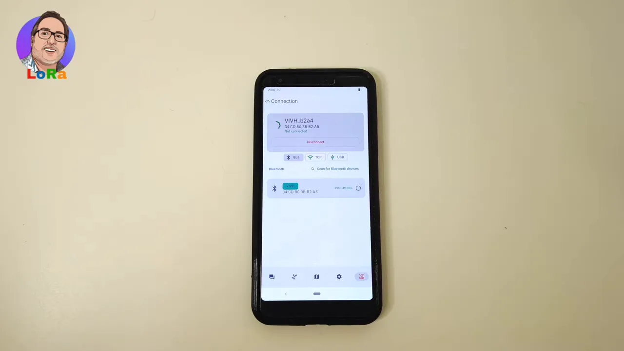
Inside Meshtastic 2.8, start by connecting to the node you want to use. In this example, the app is connected to the home base node, because that node received the track data from the mobile tracker over the air.
From there, open the node list and find the tracker node itself. Once selected, the node details page shows the information that has been received, including position data.
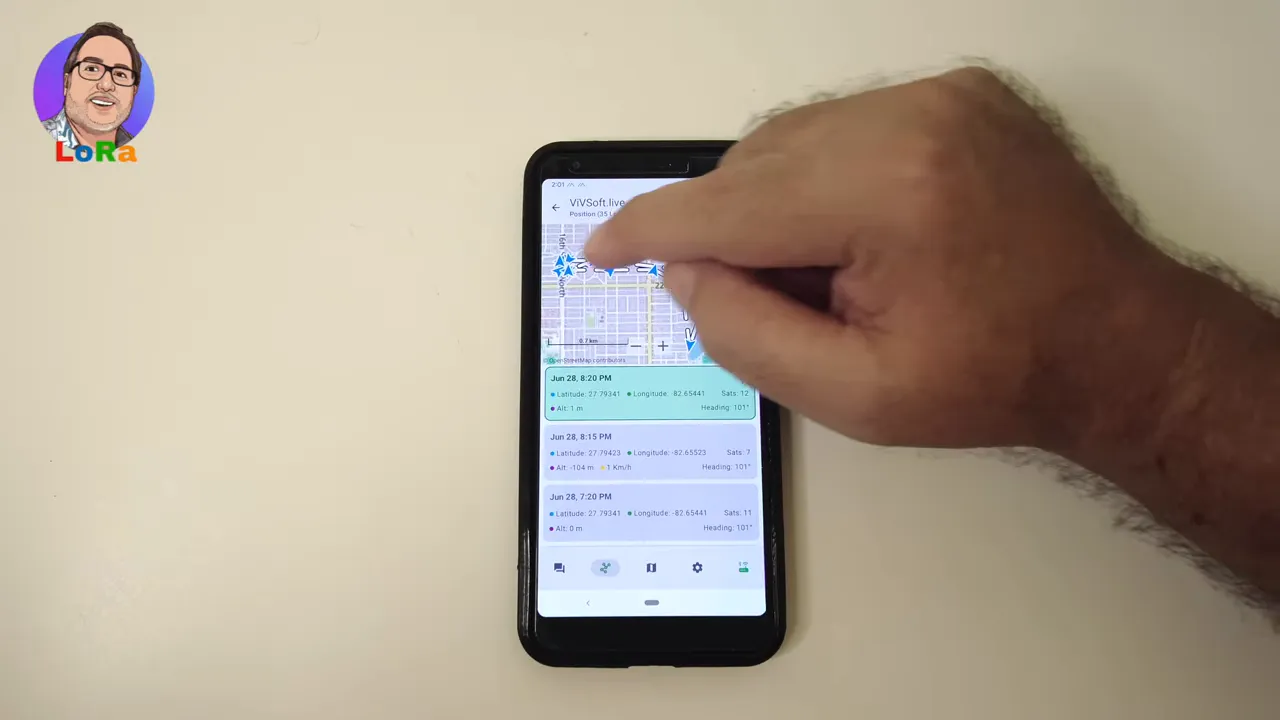
If position reports are available, you can tap into the map view and see the stored waypoints that make up the route.
Using the map inside Meshtastic
The built in Meshtastic map lets you inspect the recorded path directly in the app. Each waypoint appears on the map, and tapping one jumps to that point in the route.
You can zoom in using the plus control or with a pinch gesture, which makes it easier to inspect exactly where the node traveled. In the example route, the map clearly shows a loop around a small lake in St. Petersburg, Florida.
Because the node was only sending a position every few minutes, the route is not densely sampled. It gives you the overall shape of the trip rather than a perfect breadcrumb trail. That is not a problem with the feature itself. It simply reflects the reporting interval being used by the node. If you want a more detailed path, you would adjust how often positions are sent.
How to export a GPX file from Meshtastic
This is the part that makes Meshtastic 2.8 especially handy.
When you are viewing the route map, there is now an export button. Tapping it lets you save the track as a GPX file to your phone's file system.
The basic process looks like this:
- Open the tracker node in Meshtastic.
- Go to its map and waypoint view.
- Tap the export button.
- Give the file a name.
- Save it as a .gpx file on your device.
In the example, the file is saved with a simple test name, but the important thing is that Meshtastic creates a standard GPX file that can be reused elsewhere.
Opening the exported Meshtastic GPX file in another app
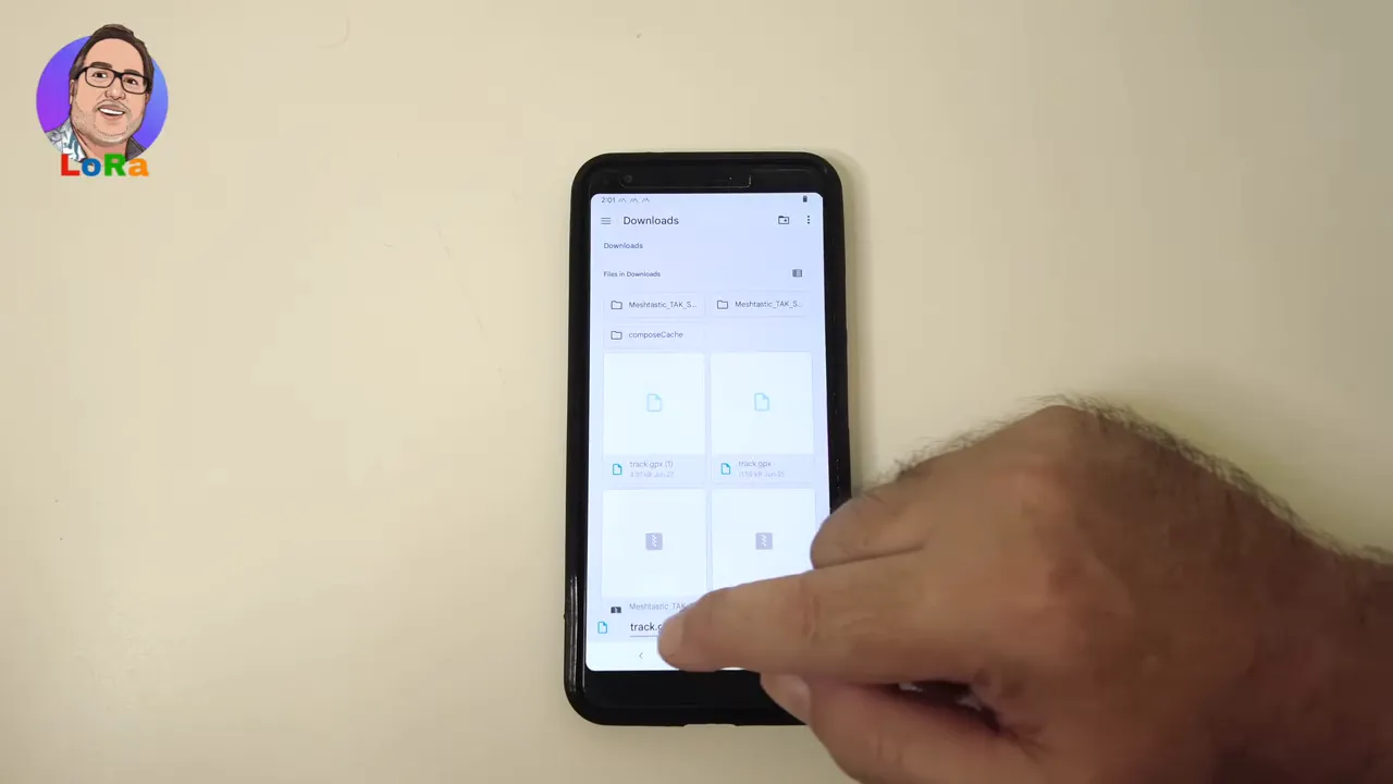
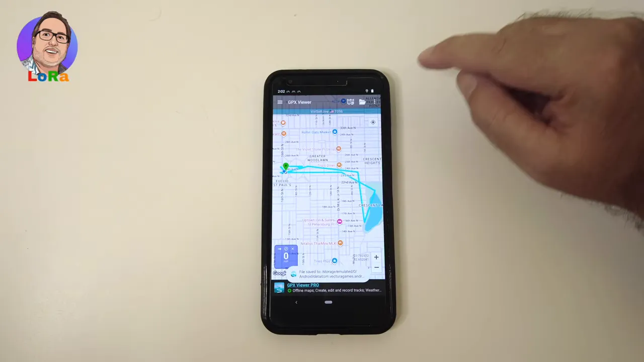
After saving the file, it can be imported into a separate GPX app. In this case, the file is opened with GPX Viewer on Android.
The workflow is straightforward:
- Leave Meshtastic after saving the GPX file.
- Open your GPX app of choice.
- Browse the phone storage for the saved file.
- Import the GPX track.
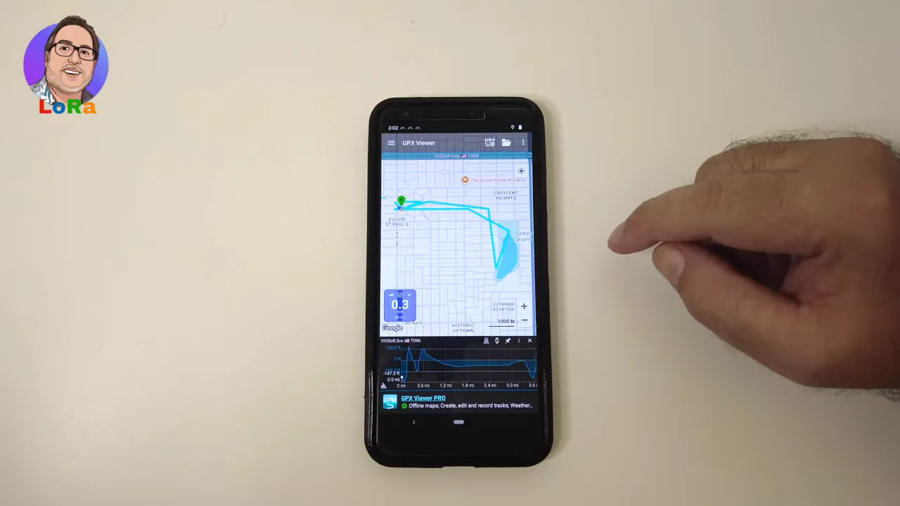
Once imported, the route appears as a normal track in the mapping app. That confirms the export is not just saving raw location points in some proprietary form. Meshtastic is generating a GPX file that other software can actually use.
What you gain by exporting from Meshtastic
The obvious win is compatibility. GPX is a common format, so your Meshtastic route is no longer stuck in one app.
That opens up a few practical advantages:
- Better analysis for hikes, walks, and test runs.
- Desktop import for archiving or comparing tracks later.
- Cleaner mapping tools if you prefer a dedicated GPX application.
- Extra data views such as elevation profiles, depending on the app you use.
In the example import, the GPX app also shows elevation information. That is a nice bonus, and it makes the exported Meshtastic track much more useful for reviewing a trip after the fact.
A few practical notes about track quality
If your exported Meshtastic route looks sparse, that usually comes down to how often the node reported its position.
A shorter interval will create a smoother and more complete path. A longer interval will still work, but the route will be made of fewer points, so turns and curves may look simplified.
For range testing or general movement logging, a lower frequency may be perfectly fine. For more precise route history, you will want more frequent updates.
Why this matters for off grid Meshtastic use
Meshtastic has always been attractive for off grid communication, but features like this push it beyond messaging and into practical field logging.
If you are carrying a node while walking a property, checking coverage, or testing a path around a park or trail, exporting that route gives you a permanent record you can reuse later. You can compare runs, share the file, archive it, or pull it into other software.
That makes Meshtastic more useful not only for hobbyists, but also for people who actually want a repeatable workflow for route tracking over LoRa.
If you want to explore more hardware options for Meshtastic, the LoRaMeshDevices store is a relevant place to start.
FAQ
Can Meshtastic 2.8 export tracks as GPX files?
Yes. Meshtastic 2.8 adds an export button in the track map view that lets you save a route as a GPX file.
Where does the Meshtastic track come from?
The route is built from position reports sent by the node. In the example setup, a T096 tracker sent those updates over LoRa to a home base node, and the app displayed that history.
Can I open a Meshtastic GPX export on a PC?
Yes. Because Meshtastic exports a standard GPX file, you can move it to a computer and import it into compatible mapping software there as well.
Why does my Meshtastic route look incomplete or blocky?
That usually means the node was reporting position at a longer interval. Fewer updates create a less detailed track. More frequent reports produce a smoother route.
What is the benefit of exporting a Meshtastic track?
The main benefit is portability. You can take your Meshtastic route into other GPX apps for better mapping, review elevation data, archive your runs, or analyze movement outside the Meshtastic app.
Final thoughts
The new GPX export feature makes Meshtastic much more flexible. You can still inspect your path inside the app, but now you are free to move that data into tools built specifically for route viewing and analysis.
For anyone using Meshtastic to track walks, coverage tests, or off grid movement, that is a meaningful upgrade. It is simple, practical, and long overdue in the best possible way.